Menu
ESI Stories
Convening for climate risks monitoring in Mocoa, Colombia
February 23, 2023
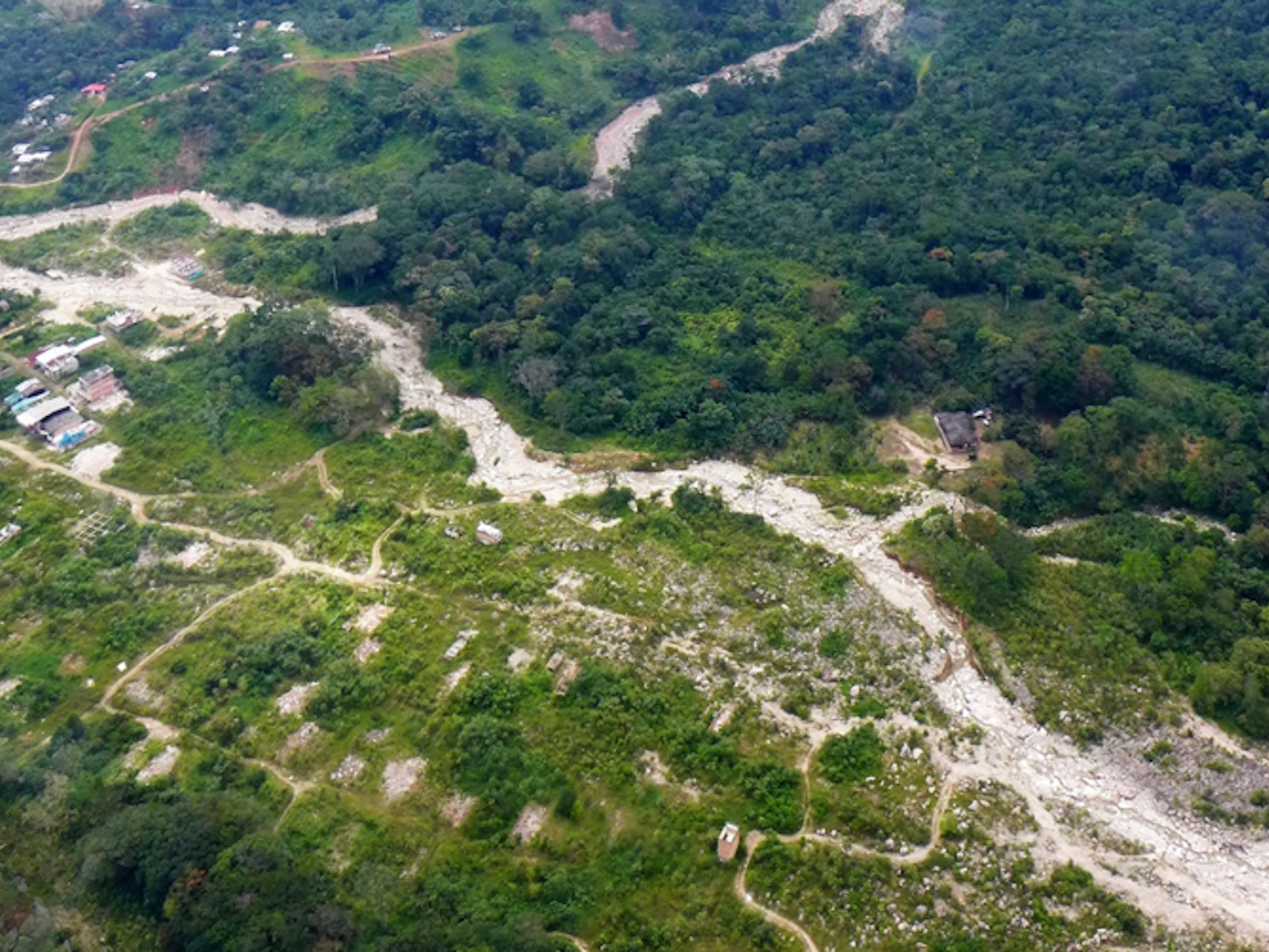
In February 2022, five years after the city of Mocoa, Colombia suffered a devastating landslide, ESI and a broad group of local and international partners launched the project Drones for Equitable Climate Change Adaptation (DECCA) to help prepare the city for future disasters. The DECCA project aims to deploy unmanned aerial vehicles (UAVs or drones) to explore the use of new technologies to provide Mocoa with an effective and robust landslide monitoring system, combined with local stakeholder engagement.
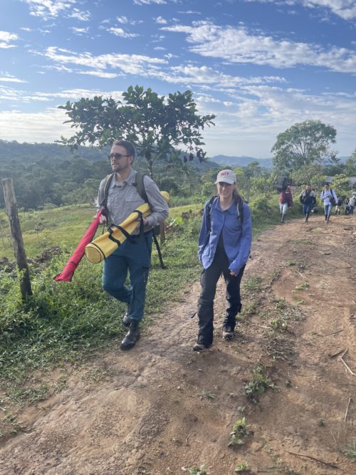
Members of the DECCA team arrive at the flight test site in Mocoa. Photo: Adam Kersnowski
Now, a delegation of seven researchers and students has returned from Mocoa after launching their first pilot flight in the field. The delegation—from ESI and project partners Lincoln Laboratories, AirWorks, the Pratt Institute Graduate Center for Planning and the Environment, and CAF Development Bank of Latin America and the Caribbean—worked hand-in-hand for a week with a team from on-the-ground partner Corpoamazonia, both to test out the UAVs and to reinforce the community relationships needed to realize the project. During their weeklong visit, the DECCA members held a series of workshops to increase local awareness, solicit feedback for a series of communication tools the project will use to keep Mocoa’s citizens informed, and strengthen local technical capacities to take part in landslide risk management.
A complex operation, technologically and socially
Flying drones in the cloud-covered and forested mountains of the Andean-Amazon piedmont is not a trivial challenge. “This has truly been the most impactful project I’ve ever been part of,” said Adam Kersnowski, AirWorks co-founder and Chief Evangelist and DECCA’s lead flight operations expert. “We made great progress in overcoming the technical challenges of flying drones in this extreme terrain, but our journey is far from over.” Kersnowski used his time in Mocoa to help train Corpoamazonia’s pilot and data collection team; over the next few months these pilots will carry out increasingly complicated flight missions. “As this project moves forward, we’ll continue to help the team build their confidence and capabilities in data collection, which is crucial to protecting the people of Mocoa from future landslides.”
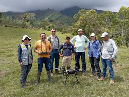
Staff from Corpoamazonia´s data collection team, Airworks, Lincoln Laboratories, ESI and the Colombian Geological service during the launch of the pilot flight. Mocoa, Colombia, January 25, 2023. Photo: Duber Rosero.
These test flights will help the DECCA team refine the workflow and flight plans for collecting data to create digital terrain models of the bare earth. The project is using machine learning to develop a landslide susceptibility model based on these data and key hydrological, geological and geomorphological features that can be extracted from the models.
At the same time, the team is building the community network needed to give this risk detection system the greatest impact in Mocoa. Under the leadership of Juan Camilo Osorio, professor at Pratt Institute’s Graduate Center for Planning and the Environment and PhD candidate at MIT, the project partners have been working with community leaders to establish a community researchers network (CRN) to participate in the three pillars of the project: technical infrastructure, engagement and capacity building, and knowledge sharing infrastructure.
As Edgar Torres, a member of the CRN, explained in his presentation to the community during a public event, “The [CRN] is designed to strengthen the participation of individuals, groups or communities and represent their interests, and in coordination with the institutional framework, use the project as an opportunity for dialogue to discuss their needs, establish collective priorities and discuss strategies to achieve responses that attend the needs of the community.”

Members of the Community Researchers Network facilitate a visioning session. Mocoa, Colombia, January 26, 2023. Photo: Madeline Chmielinski
During the project team’s visit to Mocoa, the CRN with the support of Corpoamazonia convened and co-facilitated a series of local events: a public meeting and visioning workshop, a conference, and a co-design workshop to discuss the evolving understanding of the risk of landslides. These events not only proved the convening capacity of the CRN, but more importantly, confirmed the interest of the community to engage with more sophisticated data in their understanding of risks. This buy-in and active engagement will be needed to help city officials and community members make planning decisions that will make Mocoa more resilient to future disasters.
To that end, the DECCA team has begun developing an online platform to share the results and process of the project with the citizens and key institutions in Mocoa. An early stage prototype of this platform was shared with stakeholders to gain feedback for the design process.
Next steps with the city
“Building on ESI’s five-year engagement in Mocoa, this latest visit represented a new opportunity to gain perspective and re-focus the research efforts in ways that are aligned with local priorities and the ongoing risk management efforts in Mocoa,” said Marcela Angel, Research Program Director at ESI and director of the project. “Most importantly, we were able to identify new research and collaboration opportunities consolidating an agenda for future work in Mocoa.”
These opportunities include participatory data collection and crowdsourced efforts to collect cultural and biological information, which will complement DECCA’s susceptibility analysis. DECCA also aims to develop courses for local students in the use of drones for climate risks monitoring, which will expand the use of the project’s technological infrastructure. And the DECCA team and community members will work together to elevate the role of the CRN as a regional knowledge sharing network.
Taken together, these actions set up a robust pathway for the continuation of a partnership that has been bridging the gaps of technology development and community engagement for climate risk monitoring in Colombia.
The DECCA project is supported by the Ministry of Environment and Sustainable Development of Colombia, with the economic support of the Global Environmental Facility and under implementation through CAF Development Bank of Latin America and the Caribbean. Questions about DECCA can be directed to Marcela Angel at marcelaa@mit.edu.

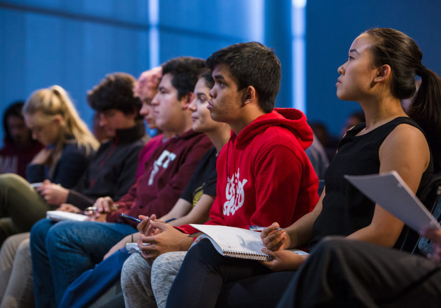
A public meeting at Corpoamazonia´s auditorium. Mocoa, Colombia, January 25, 2023. Photo: Marcela Angel

